By Rakibul Hasan, Owner of Trendy Web Stories USA | April 3, 2025

A relentless storm system has unleashed tornadoes, flash floods, and hurricane-force winds across the Central and Southern United States, leaving a trail of destruction from Missouri to Tennessee. The National Weather Service (NWS) warns of a “life-threatening” crisis as the region braces for days of severe weather. Here’s the latest on this unfolding disaster.
State-by-State Breakdown: Deaths, Injuries, and Devastation
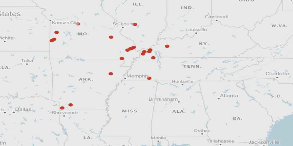
Missouri: Tornadoes Tear Through Towns
- Potosi Tornado: Residents captured a funnel cloud touching down near Potosi, with sirens blaring as the storm narrowly missed populated areas.
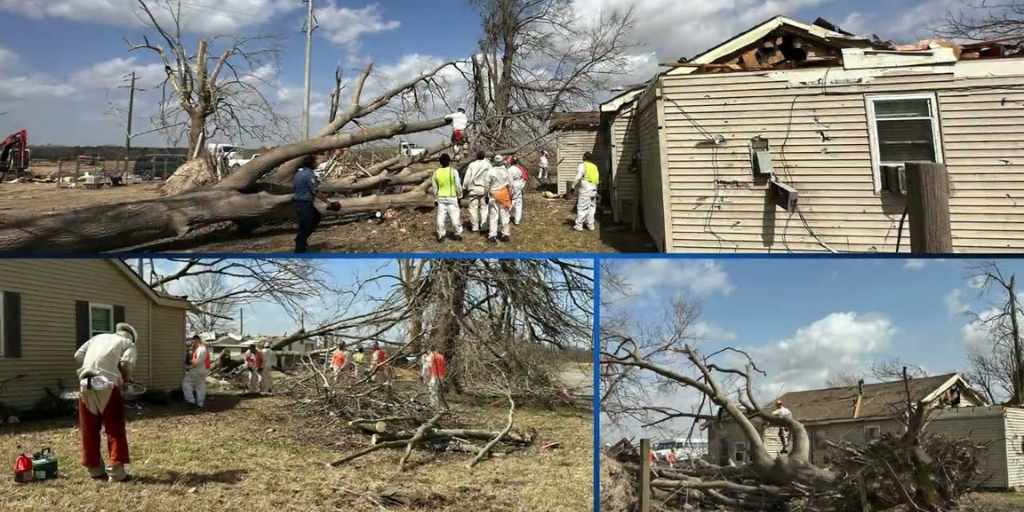
- Nevada, MO: Extensive damage reported; one injury confirmed.
- Cape Girardeau: One fatality under investigation, possibly storm-related.
- Power Outages: Over 50,000 without electricity statewide.
Arkansas: Tornadoes on the Ground
- Craighead County: Four injuries reported; 22 counties confirm structural damage.
- Hail Threat: Central and southwestern Arkansas face baseball-sized hail Thursday.
Indiana: Warehouse Collapse Traps Worker
- Brownsburg: Emergency crews rescued a woman trapped under debris after a Sur La Table warehouse collapsed.
- Power Crisis: 150,000+ customers without power—over half the regional total.
Kentucky: Child Critically Injured
- Ballard County: Four injured, including an 8-year-old boy in critical condition after a tornado struck their van.
- Paducah NWS Office: Tornado knocked out power; staff switched to backup generators.
Tennessee: State of Emergency Declared
- Middle Tennessee: “Particularly Dangerous Situation” (PDS) Tornado Watch active until 8 a.m. Thursday.
- Nashville Impact: Tornado warnings issued for Davidson County overnight.
Meteorological Analysis: Why This Storm Is Historic
Storm Origins and Path
- West Coast Onset: The system began Monday in California, gaining strength as it moved east.
- Tornado Alley Activation: By Tuesday, it triggered tornadoes in Arkansas, Missouri, and Illinois.
- Stalled Front: The system is expected to linger through Thursday, dumping 10–15 inches of rain in the Ohio River Valley.
NWS Warnings
- Flood Risk: “Catastrophic flooding” likely from the Ozarks to the Ohio River Valley.
- Tornado Threat: Long-track tornadoes, hail, and 70+ mph winds possible across Illinois, Indiana, Ohio, and Texas.
Live Updates: Middle Tennessee and Southern Kentucky

As of 6:00 a.m. CT, April 3, 2025
Code Red Alert
- Tornado Watch: Active until 8 a.m. Thursday for Middle TN and Southern KY.
- Overnight Chaos: Nonstop tornado warnings since 9 p.m. Wednesday, including Davidson County (Nashville).
Flooding Threat
- Rainfall Forecast: 5–8 inches expected in northwest Middle Tennessee.
- Wind Advisory: Gusts up to 45 mph Wednesday; sustained winds of 20–25 mph.
Timeline of Threats
- Wednesday Evening: Isolated tornadoes, hail, and high winds west of I-65.
- Thursday Morning: Flash flooding replaces tornado risk; storms linger in northwest counties.
Safety Tips: How to Survive the Storm Surge

During a Tornado
- Seek Shelter Immediately: Basements or windowless interior rooms.
- Avoid Vehicles: Abandon cars for sturdy structures.
- Monitor Alerts: Use NOAA Weather Radio or trusted apps like NWS.
Flood Preparedness
- Evacuate if Directed: Never drive through flooded roads.
- Emergency Kit: Pack water, medications, flashlights, and documents.
Economic and Infrastructure Impact

Power Grid Strain
- Regional Outages: 300,000+ customers without power across IN, OH, AR, MS, MO, KY, TN.
- Critical Facilities: Paducah’s NWS office running on backup power.
Transportation Chaos
- Road Closures: Debris and flooding block major highways in Arkansas and Missouri.
- Air Travel: Delays reported at Nashville (BNA) and Louisville (SDF) airports.
Community Response and Recovery Efforts
State Mobilization
- Tennessee: Governor Bill Lee activated National Guard units for rescue ops.
- Missouri: Highway Patrol deployed to assess damage in Cape Girardeau.
Local Heroes
- Arkansas First Responders: Rescued trapped residents in collapsing homes.
- Indiana Volunteers: Organized shelters for displaced families in Brownsburg.
Climate Context: Is This the New Normal?

Meteorologists link this outbreak to a warming climate, which fuels extreme weather patterns. The NWS reports a 20% increase in tornado activity since 2020 across the Midwest, with longer tornado seasons and more intense storms.
What’s Next?
- Thursday–Friday: Flooding replaces tornadoes as the primary threat.
- Weekend Outlook: Storms taper off Saturday, but river flooding may persist.
Stay Informed, Stay Safe
Follow Trendy Web Stories USA for real-time updates, verified safety alerts, and in-depth analysis. Share this report to keep your community prepared.

